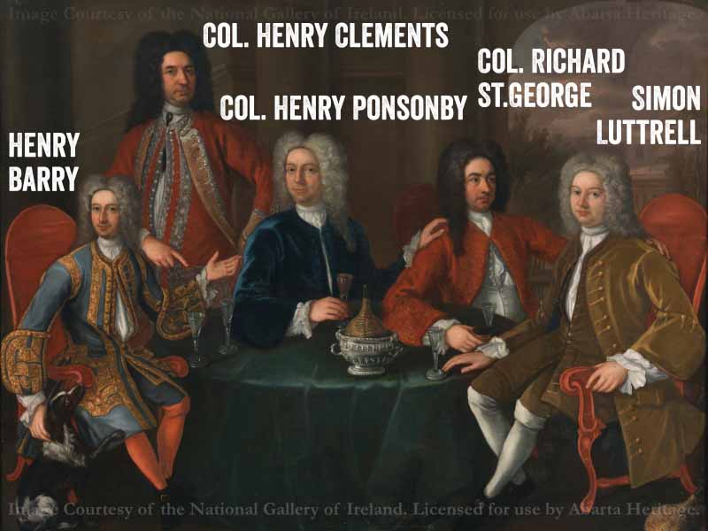
The Hellfire Club is just one chapter of the remarkable history of Montpelier Hill
While the Hellfire Club has a big story to tell, it is just one chapter in the history of Montpelier Hill.
‘Throughout their history, the Dublin Mountains have provided a scenic, more pastoral and unruly backdrop to the regulated world of the vale of Dublin.’ (1)
(A list of sources for this article are detailed at the bottom, the references appear numbered as (1), (2) etc).
The Early Medieval Period on Montpelier Hill – A Monastic Hinterland?
In the early medieval period, this region was formerly part of the territory of Ui Ceallaig Cualann, which extended from Tallaght into the foothills of the Dublin Mountains. This name was shortened to ‘O’Kelly’ in documents of the Anglo-Norman period. (2). Montpelier Hill and the surrounding lands may have become part of the hinterland estates of the important monastic foundation of Maelruan at Tallaght, located less than 5km to the north-north west of the hill. This monastery was an important liturgical and reform centre: three outstanding religious texts, the Martyrology of Aengus, the Martyrology of Tallaght and the Stowe Missal were compiled here. Tallaght was also the base of the Céile Dé (the ‘Servants of God’), a reforming community of monks, who had their headquarters in Tallaght. Such an establishment would require extensive land. (3).
Evidence of early medieval activity may be seen in the two large enclosures on Montpelier Hill (DU025-021001-) and (DU025-020002-), that may be ringforts, [enclosed farmsteads from the early medieval period], however, as these monuments have never been investigated they may equally represent an earlier phase of activity.
The Normans in Dublin
Following the Anglo-Norman conquest of the late-12th century, the Dublin and Wicklow Mountains posed an almost ever-present threat to the colonists as Gaelic forces would routinely attack the rich low-lying lands and retreat into the difficult battleground of the mountains. The remains of a 12th – 14th century castle (DU022-023002-) were identified during excavations at the late 16th–17th century towerhouse (DU022-023001-) at Dundrum in South County Dublin. The original castle is thought to have been constructed by Sir John de Clahull in 1187 to help to protect the southern approach to the city (4).
Montpelier Hill in the 17th, 18th and 19th century (c.1600–1900)
Montpelier Hill in the Post Medieval Period – Protestant Ascendency and Sporting Pursuits
The main catalysts for change in the land ownership in Montpelier Hill and County Dublin from the sixteenth and seventeenth centuries include the growing secularisation of property after the Dissolution of the Monasteries, the insertion of English settler families, and the consolidation of the property bases of leading gentry families of the Pale (5).
From c.1615 Rathfarnham Castle and its estates (including the lands of Montpelier Hill) were the property of the Loftus family, from whom it passed by marriage to Thomas Wharton after he married Lucy Loftus (6). When Thomas died in 1715, the estates were inherited by his son Philip, who became the 1st Duke of Wharton in 1718. Philip was a controversial character, prone to excessive drinking and outrageously lewd behaviour. Due to his extravagant and feckless lifestyle, Wharton became chronically entailed with debt (eventually leading to him selling his title back to the King). In 1723, William Conolly purchased Rathfarnham Castle and its estate from Wharton for the sum of £62,000. William Conolly is one of the most prominent figures of eighteenth century Ireland. He was born in Ballyshannon, County Donegal in 1662, the son of a local inn- keeper, who rose to become the wealthiest man in Ireland by the time of his death in 1729 (7).
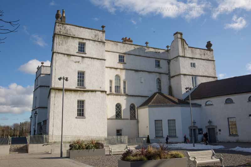
Rathfarnham Castle, County Dublin
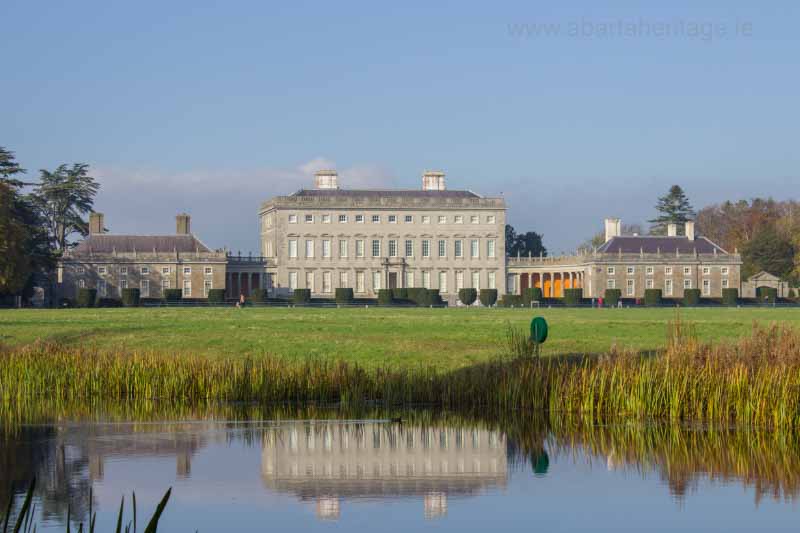
Castletown House, Celbridge, County Kildare
When Conolly purchased the estate, it consisted of 3,682 acres of arable, meadow and pasture, and 2,442 acres of mountain. The rental stood at £2,171 per annum. Conolly and his assessors calculated that the previously ‘mismanaged’ estate was capable of an additional increase of rent of £1,228 per annum. By 1782, the estate’s rent was calculated at £4,084 per annum. (8).
From researching the available portion of the Conolly Archive (available to view in the Irish Architectural Archive by appointment), I have as yet been unable to discover contemporary, primary documents relating specifically to the construction of the Hunting Lodge (that would later become known as the Hellfire Club). Such as a contract, plans or designs between Conolly and an architect, or a bill of sale for materials or similar. However a significant portion of the Conolly Archive is undergoing conservation and was therefore inaccessible, so there is still a chance that such evidence may be found during a further phase of research. We do know from contemporary, and near contemporary accounts that it was Conolly that commissioned the work. This can be seen in a reference to the establishment of the deer park that surrounded the Hunting Lodge: ‘In 1752 Roger Kendrick, surveyor to the city of Dublin, was hired to map ‘the lands of Glanasmoin’ [Glenasmole] containing fourty-four acres which had been ‘taken into Mr Connolly’s [sic] land by the stone wall which joins the road.’ (9).
It is thought possible that the Hunting Lodge was designed by the noted Palladian architect Edward Lovett-Pearce, who was employed at Castletown House by Conolly around that time (10). Though it appears quite a dark and forbidding building today, when it was first constructed it must have been a handsome and rather splendid looking lodge. It is recorded as having been plastered and whitewashed, with fine, cut-granite steps leading up to the door (11). However, William Conolly did not live long to enjoy his lodge, as he died in 1729; a mere four years after it was constructed.
The Hellfire Club on Montpelier Hill
The hunting lodge is believed to have stood empty until tradition tells that it was leased by the Hellfire Club, who have become synonymous with the building. However, the only official record of the occupation of the Hunting Lodge is the announcement in July 1751 of the death at Mount Pelier of Mr.Charles Cobbe, the elder son of the Archbishop of Dublin (12). At the end of the eighteenth century, it is reported that the then ruined Hunting Lodge temporarily sheltered another illustrious figure, General Holt, a key figure in the 1798 Rebellion.
‘That conspicuous ruin, the Hell Fire Club, gets an added attraction if one remembers that General Holt passed a night there in one of his frequent campaigns on these hills’. (13)
The association with General Holt is also reported by Patrick Healy:
‘Joseph Holt the insurgent General records that in July 1798, during the retreat of the rebels from Co. Meath, he passed safely through Dublin and spent the night in the haunted house on Mount Pelier. In spite of his perilous situation he was deeply impressed by the beauty of the sunrise, as seen from this position. He sent a message to his brother who lived in Chapel House, Bohernabreena, requesting a loaf of bread, some cheese, and a pint of whiskey.’ (14).
Historical Sources on Montpelier Hill and the Hellfire Club
The following sources were consulted:
- Smyth, W.J. 1992. ‘Exploring the Social and Cultural Topographies of Sixteenth and Seventeenth Century County Dublin’. in Aalen, F.H.A., & Whelan, K. (eds), Dublin City and County: from prehistory to present: studies in honour of J H Andrews. Dublin: Geography Publications
- Healy, P. 1961. The Valley of Glenasmole. Dublin Historical Record. Old Dublin Society. Vol.16. No.4. 109–130.
- Nolan, W. 1992. Society and Settlement in the Valley of Glenasmole c.1750–c.1900. in Aalen, F.H.A., & Whelan, K. (eds), Dublin City and County: from prehistory to present: studies in honour of J H Andrews. Dublin: Geography Publications
- O’ Brien, E. Excavations at Dundrum Castle. Excavation Licence: 1989:023. www.excavations.ie.
- Stout, G., and Stout, M. 1992. Patterns in the past: County Dublin 5000BC–1000AD in Aalen, F.H.A., & Whelan, K. (eds), Dublin City and County: from prehistory to present: studies in honour of J H Andrews. Dublin: Geography Publications.
- Smyth, W.J. 1992. Exploring the Social and Cultural Topographies of Sixteenth and Seventeenth Century County Dublin. in Aalen, F.H.A., & Whelan, K. (eds), Dublin City and County: from prehistory to present: studies in honour of J H Andrews. Dublin: Geography Publications.
- Quane, M. 1971. Speaker Conolly. Dublin Historical Record. Vol. 25. No.1. Old Dublin Society.
- Walsh, P., and Malcomson, A.P.W. 2010. The Conolly Archive. Dublin: Irish Manuscript Commission.
- Nolan, W. 1992. Society and Settlement in the Valley of Glenasmole c.1750–c.1900. in Aalen, F.H.A., & Whelan, K. (eds), Dublin City and County: from prehistory to present: studies in honour of J H Andrews. Dublin: Geography Publications.
- Fewer, M. 2016. Hellfire Hill. A Human and Natural History. Dublin: South Dublin Libraries.
- Domville Handcock, W., 1899. The History and Antiquities of Tallaght in the County of Dublin. Dublin: Hodges, Figgis.
- Healy, P. 2006. Glenasmole Roads. Dublin: South Dublin Libraries.
- W. P. H. 1913. Rambles on the Dublin Hills. The Irish Monthly, 41(485), 608-611
- Healy, P. 1961. The Valley of Glenasmole. Dublin Historical Record. Old Dublin Society. Vol.16. No.4
